Village about 800m behind the main battle line near Kolpino, August 1942.
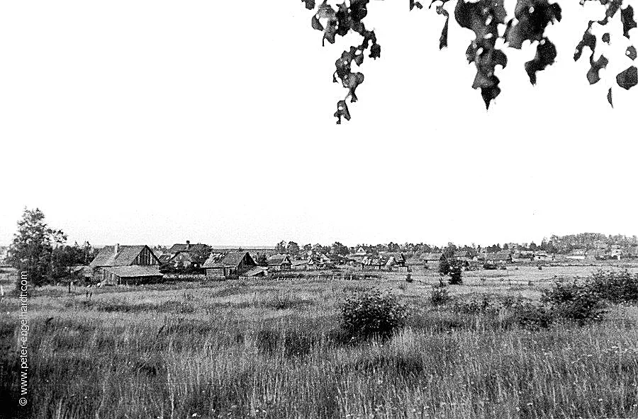
Gruber consistently misspells the name of the town Kolpino, writing it as either "Koplino" or "Choplino". In this and the following photo captions—which reflect the text of Gruber’s original labels—these place names have been corrected. Incidentally, *HKL* stands for *Hauptkampflinie* (Main Battle Line). The tall, withered grass visible in the August scene clearly indicates that no animal fodder had been harvested throughout the summer.
The situation for the civilian population in the immediate vicinity of the Main Battle Line (HKL) during the summer of 1942—particularly around Kolpino and along the Volkhov Front—was extremely precarious and shaped by several factors:
Evacuation as the norm: As a rule, villages situated directly on or immediately behind the HKL were declared "restricted areas" or "combat zones" by the Wehrmacht or the SS and subjected to forced evacuation. This served two purposes: ensuring military security (preventing espionage and the threat of partisan activity) and protecting civilians from direct artillery fire.
"Grey zones" and remaining populations: Despite these orders, a "residual population" often remained—typically the elderly or women with children—who managed to avoid evacuation or were forced to stay because they had nowhere else to go. These individuals lived in cellars or ruins right next to the front line, often just a few hundred meters from the forward German positions.
Agricultural activity: The fact that the grass in the photograph is tall and withered is a clear indication that agricultural activity in the area had come to a complete standstill. No hay harvest took place, implying that the farmers had either been driven out or that their livelihood had been effectively destroyed by the military occupation of the area.
Distance to the Main Line of Resistance (MLR): The physical distance varied greatly. While the village in the image remains recognizable as such, the absence of any agricultural activity suggests that it no longer served as a civilian settlement but rather functioned as a military outpost or a "dead" zone.
It can therefore be assumed that—even if any civilians remained there—the village no longer served a civilian function in the true sense of the word, but instead formed part of a military security zone.
The visually distinct text was created in July 2026 with the help of the AI Gemini. - Page translated with Google.
© Peter Engelhardt, www.peter-engelhardt.com. All rights reserved.


